Trains, ships, aircraft, submarines and the space shuttle all use GPS to navigate. Many people use receivers when driving cars. Some hikers use GPS to help them find their way, especially when they are not on marked trails.
Most of us use GPS technology every day without a second thought. But do you really understand it? What is GPS tracking and how does it work?
❗Today we would like to answer these questions.
Let’s begin with the name, GPS, which stands for Global Positioning System 🛰
For many people, the word GPS has become collective. But GPS is one example of several Global Navigation Satellite Systems (GNSS) in use today. GNSS typically includes GPS, Baidu, Galileo, GLONASS and many other constellation systems.
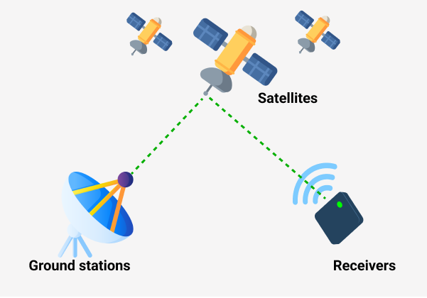
Both GPS and GNSS consist of three major segments:
Satellites – They serve like stars in the constellation. We know where they are supposed to be at any given time
Ground stations – They monitor and control satellites. Ground stations also identify their location.
Receivers – Receivers are constantly listening for signals from the satellites. Highly advanced receivers can even identify the exact location within a fraction of an inch.

The data at the heart of a GPS signal is time — specifically, the exact time the signal left the satellite. The receiver then logs the exact time it gets the signal, and the time difference is computed to a distance.
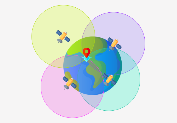
Once the receiver calculates its distance from GPS satellites, it knows exactly where you are.
It takes four GPS satellites to calculate a precise location on the Earth using the Global Positioning System: three to determine a position on the Earth, and one to adjust for the error in the receiver’s clock.

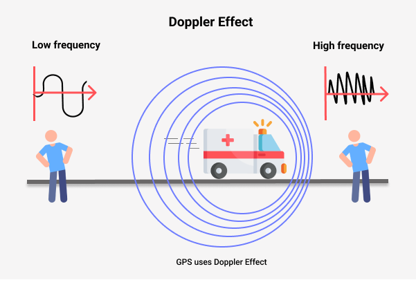
Doppler Effect is the fundamental principle used in GPS.
Changes in signal frequency from the GPS satellites help in determining locations and speed.

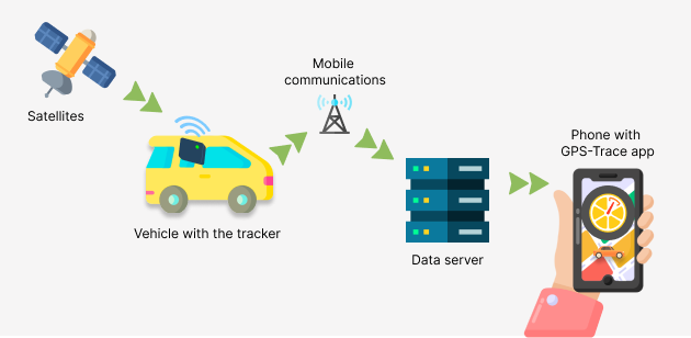
But how do users see the location of their units in our app?
The tracker, installed on your car, motobike, animal or any other property, receives this data and transmits it via mobile communications(SIM card) in its raw form to our server. On our servers, the data from the tracker is parsed and takes on a convenient and understandable form for our users.
Then the data from the servers goes to the application, after which see them on your smartphone or laptop via a web browser.
The process may seem long, but all these operations take place in a second or less.

When creating a unit, the user should direct his device to the IP and Port specified in the Unit settings (Hardware tab). So that the device can connect to our platform and the system receives all the messages that the tracker sends.
The second important condition is Internet connection, without it the device will not connect to the server.
Now you know how GPS works and how our app is related to it.
It remains only to install our application and connect the tracker 😉